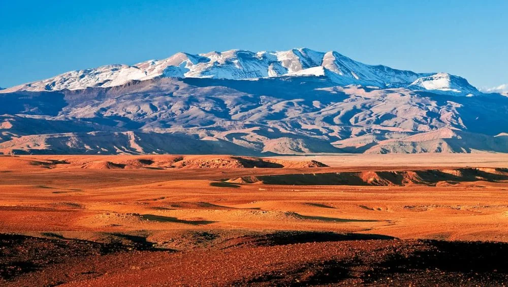
The Map of the Atlas Mountains in Africa is an essential resource for anyone planning to explore one of the continent’s most breathtaking mountain ranges. Stretching across Morocco, Algeria, and Tunisia, the Atlas Mountains offer a remarkable blend of rugged peaks, green valleys, traditional Berber villages, and unforgettable landscapes.
Whether you are an experienced trekker or simply looking for scenic road trips, understanding the geography of the region helps you make the most of your adventure.
From snow-capped summits to dramatic gorges and peaceful forests, this mountain range provides countless opportunities for outdoor enthusiasts. A well-planned route allows travelers to experience the cultural richness and natural beauty that have made the Atlas Mountains a favorite destination for hikers from around the world.
Understanding the Atlas Mountains
The Atlas Mountains span approximately 2,500 kilometers across North Africa. The range is divided into several sections, including the High Atlas, Middle Atlas, Anti-Atlas, Tell Atlas, and Saharan Atlas. Each region has its own unique landscape, climate, and attractions.
Using a map of the Atlas Mountains in Africa makes it easier to understand how these sections connect. Travelers can identify major cities like Marrakech, Imlil, Ouarzazate, and Midelt, which serve as popular starting points for hiking adventures.
The Atlas Mountains map is especially useful for locating mountain passes, national parks, and scenic valleys before setting out on a journey.
Why a Detailed Map Matters
Exploring the Atlas Mountains without proper planning can be challenging due to the vast terrain and changing weather conditions. A detailed map helps visitors:
- Choose hiking routes based on difficulty
- Locate nearby villages and accommodations
- Identify rivers, valleys, and mountain passes
- Plan transportation between destinations
- Estimate travel times more accurately
Digital navigation is helpful, but carrying an offline or printed map is highly recommended since mobile coverage can be limited in remote areas.
Top Hiking Routes in the Atlas Mountains
Mount Toubkal Trek
Mount Toubkal stands at 4,167 meters and is the highest peak in North Africa. Most hikers begin their adventure from the village of Imlil before making their way to the mountain refuge.
The trail offers spectacular views of rocky cliffs, alpine landscapes, and distant valleys. During the warmer months, the climb is suitable for reasonably fit hikers, while winter requires mountaineering equipment and experience.
When reviewing a map of the Atlas Mountains in africa, Mount Toubkal is one of the easiest landmarks to identify because of its popularity.
Imlil to Aroumd Village
This relatively easy route is ideal for families and beginners. The trail winds through walnut groves, traditional Berber settlements, and terraced farmland.
Visitors enjoy panoramic mountain scenery while experiencing authentic local culture. Small guesthouses along the route provide opportunities to sample traditional Moroccan cuisine.
Ait Bouguemez Valley
Known as the “Happy Valley,” Ait Bouguemez features peaceful walking trails surrounded by fertile farmland and dramatic mountain backdrops.
The valley is perfect for travelers seeking less crowded hiking experiences. Local guides often introduce visitors to ancient irrigation systems and centuries-old villages.
Scenic Driving Routes Worth Exploring
Not every visitor wants to tackle challenging mountain hikes. Fortunately, several roads offer incredible scenery with minimal physical effort.
Tizi n’Tichka Pass
Connecting Marrakech with Ouarzazate, this mountain pass is among Morocco’s most famous scenic drives. The winding road climbs above 2,200 meters, providing breathtaking panoramic views.
Small roadside markets sell handmade carpets, pottery, and local crafts, making the drive even more memorable.
Dades Gorge
Dades Gorge features dramatic rock formations and one of the most photographed winding roads in Morocco.
The route includes numerous viewpoints where travelers can stop to admire towering cliffs and deep valleys carved by centuries of flowing water.
Todra Gorge
Although technically better known for rock climbing, Todra Gorge also offers beautiful walking paths between towering limestone walls.
Photographers particularly appreciate the changing sunlight throughout the day, creating constantly shifting colors on the canyon walls.
Hidden Scenic Trails
While famous routes attract many visitors, the Atlas Mountains also hide countless lesser-known paths.
Ouzoud Region
The trails surrounding Ouzoud Waterfalls combine forests, rivers, and spectacular waterfalls. Wildlife enthusiasts often spot Barbary macaques living in the surrounding woodlands.
Middle Atlas Cedar Forests
The cedar forests near Azrou provide peaceful hiking opportunities beneath ancient trees. Cooler temperatures make this region especially pleasant during the summer months.
Anti-Atlas Landscapes
The Anti-Atlas presents a completely different environment with red granite peaks, desert scenery, and unique rock formations. Hikers looking for solitude often prefer this quieter section of the mountain range.
An Atlas Mountains map helps travelers distinguish these diverse regions and select trails that match their interests.
Best Time to Visit
The ideal season depends on your planned activities.
Spring (March to May) offers blooming wildflowers, comfortable temperatures, and excellent hiking conditions.
Summer (June to August) brings warm weather to lower elevations, although higher mountain trails remain enjoyable.
Autumn (September to November) provides clear skies, colorful landscapes, and fewer tourists.
Winter (December to February) transforms the High Atlas into a snowy paradise suitable for experienced mountaineers and winter sports enthusiasts.
Checking weather forecasts before departure is always recommended, especially for high-altitude routes.
Essential Hiking Tips
Preparation significantly improves safety and enjoyment.
- Carry sufficient drinking water.
- Wear sturdy hiking boots with good grip.
- Pack warm clothing for changing temperatures.
- Download offline navigation before your trip.
- Inform someone of your hiking plans.
- Respect local customs when visiting Berber communities.
- Consider hiring local guides for remote trails.
A reliable map of the atlas mountains in africa remains one of the most valuable items in any hiking backpack.
Wildlife and Natural Beauty
The Atlas Mountains support diverse ecosystems rarely found elsewhere in North Africa.
Visitors may encounter:
- Barbary macaques
- Golden eagles
- Mountain foxes
- Wild boar
- Numerous native bird species
Spring brings colorful wildflowers across mountain meadows, while ancient cedar forests provide habitats for unique wildlife.
Nature photographers often spend days exploring the changing light across valleys, cliffs, and mountain peaks.
Cultural Experiences Along the Routes
The Atlas Mountains are not only about dramatic scenery. They are also home to Berber communities whose traditions have remained remarkably well preserved.
Many villages welcome visitors with locally prepared meals, handmade crafts, and comfortable guesthouses. Walking through these settlements offers insight into a slower pace of life where agriculture, hospitality, and family remain central.
Travelers often discover weekly markets filled with spices, woven rugs, pottery, and fresh produce. These experiences add cultural depth to any hiking adventure.
Before beginning longer treks, many visitors consult an Atlas Mountains map to identify villages where they can rest, refill supplies, or arrange overnight accommodations.
Conclusion
Exploring the Atlas Mountains is an unforgettable experience filled with spectacular scenery, rewarding hiking trails, and rich cultural encounters. Whether your goal is reaching the summit of Mount Toubkal, driving through dramatic mountain passes, or discovering hidden valleys, careful planning makes every journey more enjoyable.
Using a map of the Atlas Mountains in africa allows travelers to confidently navigate the region while uncovering some of North Africa’s most impressive natural landscapes. With the right preparation, every route offers opportunities for adventure, breathtaking photography, and meaningful connections with the communities that call these mountains home.