Why Location Intelligence Matters in Modern Fleet Management
U.S. fleet and delivery operations have grown far more complicated than the simple “point A to point B” model of a decade ago. Customers now expect delivery windows measured in minutes rather than days. Traffic and route disruptions can derail even well-planned schedules. Dispatchers still spend hours confirming arrivals and departures by phone, and drivers often rely on manual check-ins that slow everyone down. At the same time, unauthorized vehicle movement — a truck leaving a depot after hours, an asset drifting outside its approved territory — remains a persistent security concern. Layered on top of all this is a growing demand for real-time visibility: shippers, customers, and operations teams alike want to know not just where a vehicle is, but what is happening with it right now.
GPS and telematics solved the first half of that problem. They tell fleet managers where a vehicle sits on a map at any given moment. But knowing a vehicle’s coordinates is not the same as knowing what should happen once it reaches a particular place. That is where geofencing comes in. Geofencing takes raw location data and turns it into automated operational events — arrivals, departures, alerts, notifications, and workflow triggers — without someone having to watch a map and react manually.
This article focuses on how geofencing applies specifically to U.S. logistics providers, fleet operators, delivery companies, field-service businesses, and transportation organizations, and why it is becoming a foundational layer of modern fleet technology rather than a nice-to-have add-on.
Key takeaway: Geofencing can transform passive GPS information into location-triggered workflows.
What Is Geofencing in Fleet Management?
Definition of Geofencing
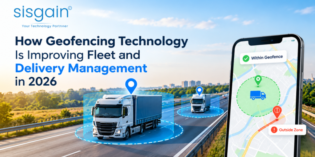
A geofence is a virtual geographic boundary drawn around a physical location. It can be as small as a single loading dock or as large as an entire delivery territory. In fleet operations, geofences are commonly placed around:
- Warehouses
- Distribution centers
- Customer locations
- Service areas
- Fuel stations
- Restricted zones
- Parking facilities
- Depots
Once a boundary is defined, any vehicle carrying a GPS or telematics device can be monitored against it.
How Fleet Geofencing Works
At a technical level, fleet geofencing follows a fairly consistent process:
GPS/Telematics Data → Location Detection → Geofence Boundary → Event Detection → Automated Action → Reporting
- A vehicle’s location is transmitted continuously through GPS or telematics hardware.
- Software compares those coordinates against predefined geographic boundaries.
- The system detects entry, exit, dwell, or other location-based events.
- Based on that event, the platform can trigger alerts, update statuses, send notifications, or kick off broader workflows.
Modern geofencing systems rarely stop at detection. They commonly connect location events with dispatch systems, reporting dashboards, alerting tools, and operational workflows so that a single location trigger can ripple across multiple business systems at once.
Geofencing vs. GPS Tracking
It helps to separate the two concepts clearly:
| GPS Tracking | Geofencing |
|---|---|
| Shows vehicle location | Creates location-based rules |
| Provides visibility | Triggers actions |
| Answers “Where is it?” | Answers “What happened here?” |
| Primarily monitoring | Monitoring + automation |
GPS tracking is the foundation; geofencing is the layer that makes that foundation operationally useful.
Why Geofencing Is Becoming Important for U.S. Fleet Operations
Several operational pressures are pushing U.S. fleets toward geofencing adoption:
- Customers increasingly expect real-time delivery visibility, not just a delivery date.
- Businesses need more accurate arrival information to plan labor, docks, and downstream operations.
- Routes are becoming more complex, with multi-stop delivery patterns that are difficult to track manually.
- Fleet managers are under pressure to improve asset utilization and reduce idle time.
- Administrative teams want to cut down on manual data entry and status updates.
- Security concerns around vehicle and asset movement — theft, unauthorized use, after-hours activity — continue to grow.
- Fleets are adopting more connected technologies overall, from telematics to IoT sensors to dispatch software.
Geofencing provides an additional operational layer on top of standard GPS and telematics data. Rather than replacing these systems, it makes them actionable. Current fleet platforms increasingly connect geofencing directly with real-time asset monitoring and automated alerting, so that a location event doesn’t just sit in a log file — it prompts a response.
Key Ways Geofencing Technology Improves Fleet and Delivery Management
Automating Vehicle Arrival and Departure Tracking
Geofences placed around warehouses, distribution centers, customer locations, and service sites can automatically record when a vehicle arrives and departs, without anyone lifting a phone or filling out a log.
This brings several practical benefits:
- Less manual check-in work for drivers and site staff
- More accurate timestamps for arrivals and departures
- Better operational records for audits and performance reviews
- Easier coordination for dispatch teams planning the next stop
- Improved visibility into overall site activity and traffic patterns
Improving Delivery Visibility and Customer Notifications
A geofence placed around a customer’s location can trigger an event the moment a vehicle approaches or arrives, feeding directly into customer-facing communication.
A typical workflow looks like this:
Vehicle Approaches → Geofence Trigger → Delivery Status Updated → Customer Notified
This kind of automation supports:
- Automated delivery notifications
- More accurate ETA communication
- Real-time delivery status updates
- Fewer manual customer service calls
- Better last-mile visibility for both the business and the customer
Geofencing is increasingly used specifically around delivery locations to support these automated arrival notifications, reducing the gap between “the truck is near” and “the customer knows the truck is near.”
Monitoring Route Compliance and Restricted Areas
Businesses can establish geofences around restricted roads, prohibited areas, customer-specific zones, hazardous locations, low-clearance routes, and approved service territories. If a vehicle enters a restricted area, the system can generate an immediate alert.
For example, a U.S. logistics company might establish a restricted-area geofence around a road that is unsuitable for certain commercial vehicles — perhaps due to weight limits or clearance restrictions. If a vehicle enters that zone, dispatch receives an alert and can contact the driver to redirect them before the situation becomes costly.
It’s worth emphasizing that geofencing supports monitoring and exception handling — it flags situations that need human attention rather than replacing operational judgment altogether.
Reducing Unauthorized Vehicle and Asset Movement
After-hours geofencing is one of the more security-focused applications of this technology. A depot geofence combined with a defined business-hours rule can catch unusual activity immediately:
Depot Geofence → Business Hours Rule → Vehicle Exits at 2:00 AM → Automated Alert
This approach supports a range of use cases, including:
- Theft detection
- Identifying unauthorized vehicle use
- Flagging after-hours movement
- General asset security
- Spotting suspicious route deviations
Fleet platforms can use these geofence-based alerts to identify vehicles or assets moving outside their defined operational areas, often catching problems long before they would otherwise be noticed.
Reducing Idle Time and Improving Fleet Utilization
Geofencing can also help identify excessive dwell times at warehouses, loading docks, customer facilities, distribution centers, and yards — locations where vehicles often sit longer than necessary.
Consider a simple example: a truck enters a distribution center at 9:00 AM but doesn’t leave until 11:30 AM. Rather than that delay going unnoticed, the geofencing system records the full dwell period, giving operations teams the data they need to identify recurring bottlenecks.
This kind of dwell-time analysis is useful for spotting:
- Loading and unloading delays
- Yard congestion
- Underutilized vehicles
- Broader operational bottlenecks across a network of sites
Supporting Automated Fleet Workflows
Geofencing becomes significantly more valuable when it’s connected to broader workflow automation rather than treated as a standalone alerting tool.
For example:
Vehicle Enters Warehouse → TMS Status Updated → Warehouse Team Notified → Delivery Workflow Starts
Or on the other end of a trip:
Vehicle Leaves Depot → Dispatch System Updated → Customer ETA Workflow Activated
These examples illustrate a clear evolution in how the technology is used:
Location Data → Operational Event → Automated Workflow
Instead of a location update simply appearing on a dashboard, it becomes the starting point for a chain of automated actions across multiple systems.
Supporting AI-Powered Fleet Decision-Making
Geofencing also plays a growing role in feeding structured location data to AI-enabled logistics platforms. A representative sequence might look like this:
- AI detects repeated late arrivals at a specific facility.
- The system analyzes historical dwell-time data for that location.
- AI identifies a recurring operational bottleneck — perhaps a congested loading dock or an unrealistic scheduling window.
- The platform recommends a schedule or route adjustment.
- Human operations staff reviews the recommendation before it’s implemented.
It’s important to draw a clear distinction here: geofencing itself is not necessarily AI. Rather, geofencing generates the high-quality, structured operational signals — arrival times, dwell durations, route deviations — that AI and analytics systems depend on to produce useful recommendations. Geofencing is the data layer; AI is the decision-support layer built on top of it. Improving Fleet Reporting and Operational Analytics
Every geofence event creates a data point, and over time those data points accumulate into a rich, structured historical record. Businesses can analyze:
- Arrival times
- Departure times
- Dwell duration
- Frequency of visits to specific sites
- Route deviations
- Restricted-zone events
- After-hours activity
- Delivery-site performance
This data can feed directly into operational dashboards, supporting more informed decision-making across dispatch, customer service, and fleet management teams.
How Geofencing Works With IoT, GPS, Cloud, and AI

Geofencing rarely operates in isolation. It sits within a broader technology ecosystem.
GPS & Telematics provide the core vehicle location and movement data that geofencing depends on.
IoT Devices extend that picture. Vehicle sensors and other connected devices can supply additional operational context, such as vehicle condition, temperature readings, fuel usage, cargo conditions, and equipment status — all of which can be combined with location events for a fuller operational picture.
Cloud Infrastructure underpins most modern geofencing platforms. Cloud-based infrastructure allows fleet software to process and store geofence events across distributed fleets, often spanning multiple states or regions. Modern geofencing platforms often rely on scalable cloud infrastructure solutions to process location events, maintain fleet records, and connect multiple operational systems in near real time.
IoT Integration matters just as much on the connectivity side. Connected vehicles and sensors need to reliably communicate with fleet applications, which is often where working with an experienced internet of things app development company becomes valuable for businesses building custom geofencing capabilities.
Logistics Software ties everything together. Geofencing delivers the most value when it integrates with existing Transportation Management Systems (TMS), Warehouse Management Systems (WMS), Enterprise Resource Planning (ERP) platforms, Customer Relationship Management (CRM) tools, dispatch platforms, and customer-facing portals.
Geofencing Use Cases Across U.S. Industries
Transportation & Logistics — shipment monitoring, route compliance, delivery tracking, depot management.
Last-Mile Delivery — customer notifications, arrival confirmation, delivery status automation.
Field Service — technician arrival tracking, service-area monitoring, automated job status updates.
Construction — equipment movement tracking, job-site arrival confirmation, unauthorized asset movement alerts.
Waste Management — route monitoring, service-zone tracking, collection-site verification.
Retail & Distribution — warehouse arrival tracking, yard management, distribution visibility.
Cold-Chain Logistics — location events combined with temperature and other IoT data to provide greater visibility into sensitive shipments, helping ensure product integrity throughout transit.
Integrating Geofencing Into a Modern Logistics Software Platform
Building geofencing into a logistics platform generally requires several essential components working together.
GPS and Telematics Integration — capturing vehicle location, trip history, and movement events as the raw data source.
Geofence Management — tools to create zones, edit boundaries, define entry and exit rules, and configure dwell-time thresholds.
Alert Management — push notifications, SMS and email alerts, dashboard-based alerts, and escalation rules for unresolved issues.
Workflow Automation — automatically updating statuses, triggering dispatch actions, sending customer notifications, and creating follow-up tasks.
Analytics Dashboard — dwell-time reports, arrival and departure history, route compliance tracking, and zone activity summaries.
System Integration — connecting geofencing data with the business systems that already run day-to-day operations. Working with a specialized logistics software development company can help businesses integrate geofencing with existing TMS, ERP, WMS, telematics, and customer-facing systems, rather than treating geofencing as a disconnected feature.
Best Practices for Implementing Fleet Geofencing

Start With High-Value Locations. Avoid creating hundreds of geofences all at once. Begin with major warehouses, key customer sites, depots, restricted zones, and high-priority delivery locations, then expand as the system proves its value.
Define Clear Trigger Rules. Decide explicitly what should count as an event — entry, exit, a specific dwell-time threshold, or after-hours movement — so the system behaves predictably.
Avoid Alert Overload. Too many alerts quickly become noise that teams learn to ignore. Aim for a simple chain
Relevant Alert → Assigned Person → Clear Action.
Account for GPS Accuracy. GPS positioning is not perfectly precise, particularly around tall buildings, dense urban environments, or complex multi-building sites. Use appropriately sized boundaries and validation rules to avoid false triggers.
Protect Location Data. Location data is sensitive operational information. Implement strong access controls, encryption, authentication, audit logs, sensible data retention policies, and appropriate permission structures.
Measure Business Outcomes. Track meaningful KPIs such as average dwell time, delivery arrival accuracy, unauthorized movement events, reduction in manual status updates, volume of customer ETA inquiries, and overall vehicle utilization.
Choosing the Right Technology Partner
Selecting a development partner for geofencing capabilities requires evaluating experience across several technical areas: GPS integrations, telematics APIs, geospatial technology, IoT, cloud platforms, TMS/WMS/ERP integration, mobile applications, real-time dashboards, and AI and automation capabilities.
Businesses looking to build customized geofencing capabilities can turn to specialized logistics software development services to integrate location intelligence into their existing operational workflows, rather than trying to bolt geofencing onto legacy systems on their own.
The Future of Geofencing: From Location Tracking to Intelligent Automation
Geofencing technology continues to evolve along a fairly clear trajectory:
GPS Tracking → Geofencing → Workflow Automation → Predictive Analytics → AI-Assisted Operations
Looking ahead, several capabilities are likely to become more common in fleet platforms: predictive arrival management, AI-assisted exception detection, dynamic geofence rules that adjust based on conditions, more sophisticated automated customer communication, intelligent route monitoring, cross-system workflow orchestration, and context-aware alerts that account for more than just a vehicle’s position.
The real value in all of this comes from combining geofencing with broader data and software systems, rather than treating it as an isolated feature bolted onto a fleet map.
Conclusion
Geofencing converts raw location data into actionable operational events. It improves fleet visibility, automates arrival and departure tracking, and supports more reliable delivery notifications. It helps businesses monitor restricted areas and catch unauthorized vehicle movement before it becomes a costly problem. And it generates the structured data that powers meaningful analytics and, increasingly, AI-assisted operational decisions.
None of this happens in isolation, though. Geofencing delivers the most value when it’s integrated with GPS, IoT, cloud infrastructure, and the TMS, WMS, and ERP systems that already run day-to-day operations. As more U.S. fleets adopt connected technologies, geofencing is positioned to move from a helpful add-on to a foundational layer — one that helps businesses build more connected, responsive, and efficient fleet operations going forward.

Frequently Asked Questions
What is geofencing in fleet management?
Geofencing is the use of virtual boundaries around physical locations — like warehouses, customer sites, or restricted zones — to automatically detect when a vehicle enters, exits, or dwells within that area, triggering alerts or automated actions.
How does geofencing work with GPS tracking?
GPS tracking provides the raw location data, while geofencing compares that data against predefined boundaries to detect meaningful events. GPS tells you where a vehicle is; geofencing tells you what to do about it.
What are the benefits of geofencing for delivery management?
Geofencing automates arrival and departure tracking, improves delivery visibility, supports real-time customer notifications, and reduces the manual work involved in confirming vehicle status.
Can geofencing notify customers when a vehicle arrives?
Yes. A geofence placed around a customer location can trigger an automated status update or notification the moment a vehicle approaches or arrives, reducing reliance on manual driver check-ins.
How does geofencing help prevent unauthorized vehicle movement?
By combining location boundaries with rules like business hours, geofencing can flag unusual activity — such as a vehicle leaving a depot in the middle of the night — and generate an immediate alert for review.
Can geofencing integrate with logistics software?
Yes. Geofencing is commonly integrated with TMS, WMS, ERP, CRM, and dispatch platforms so that location events can trigger broader operational workflows rather than sitting in an isolated system.
Is geofencing an IoT technology?
Geofencing relies on location data that often comes from GPS and telematics hardware, and it’s frequently combined with IoT sensor data (temperature, fuel usage, equipment status) for a fuller operational picture — but geofencing itself is best understood as a software capability built on top of that data.
How accurate is GPS geofencing?
GPS accuracy can vary, particularly in dense urban environments or around large buildings. Well-designed geofencing systems account for this by using appropriately sized boundaries and validation rules to reduce false triggers.