Morocco’s Atlas Mountains stretch like a rugged backbone across the country, shaping landscapes, cultures, and travel experiences in unforgettable ways. For adventurers and planners alike, understanding the geography through a map of Morocco’s Atlas Mountains opens up a world of possibilities, from snow-capped peaks to remote Berber villages and hidden valleys.
Understanding the Atlas Mountain System
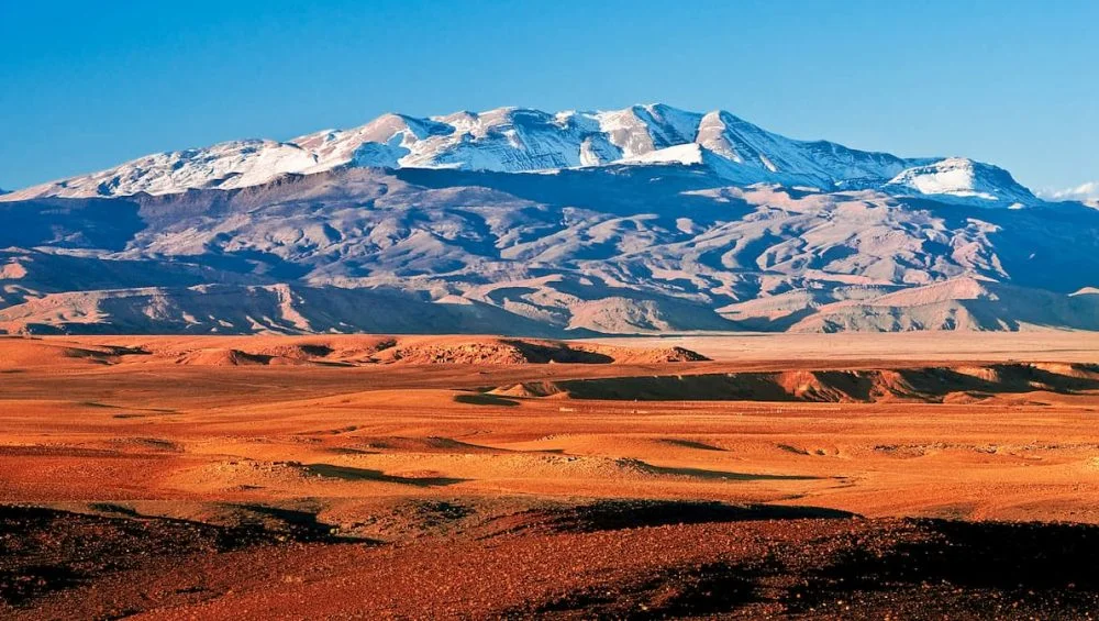
The map of Morocco’s Atlas Mountains is not a single range but a vast system divided into three main regions: the High Atlas, Middle Atlas, and Anti-Atlas. Each area offers distinct terrain, climate, and cultural experiences. A well-detailed map of the Atlas Mountains in Morocco helps travelers visualize how these regions connect and where to focus their journey.
The High Atlas, often called the “Roof of North Africa,” contains the tallest peaks, including Mount Toubkal. The Middle Atlas is known for its cedar forests and cooler climate, while the Anti-Atlas presents a more arid, dramatic landscape with rocky plateaus and hidden oases.
Key Regions to Explore
High Atlas: The Heart of Adventure
The High Atlas Mountains of Morocco are the most popular for trekking and climbing. Using a map of Morocco’s Atlas Mountains, you’ll notice how this region stretches from the Atlantic coast toward the Algerian border.
Highlights include:
Imlil Valley, a gateway for Mount Toubkal treks
Aït Bouguemez is known as the “Happy Valley.”
Ouzoud Waterfalls, one of Morocco’s most scenic natural attractions
This region is ideal for those seeking challenging hikes and authentic mountain culture.
Middle Atlas: Forests and Lakes
Map of Morocco’s Atlas Mountains, the Middle Atlas offers a softer, greener landscape. On a map of Morocco, the Atlas Mountains in this area appear closer to cities like Fez and Meknes, making it more accessible.
Key features include:
Cedar forests near Azrou, home to Barbary macaques
Lake Dayet Aoua, perfect for picnics and birdwatching
The town of Ifrane is often called “Little Switzerland.”
This region is perfect for relaxed exploration and nature lovers.
Anti-Atlas: Remote and Untouched
The Anti-Atlas lies in southern Morocco and is often overlooked. However, a closer look at a map of Morocco’s Atlas Mountains reveals its vast, less-traveled terrain.
Highlights include:
- Tafraoute, famous for its pink granite rocks
- Ameln Valley, dotted with traditional villages
- Hidden oases and ancient trade routes
This region offers solitude and raw beauty, ideal for off-the-beaten-path travelers.
Scenic Routes Through the Mountains
Exploring the Atlas Mountains by road is one of the best ways to experience their diversity. A reliable map of the Atlas Mountains in Morocco is essential for navigating these routes.
Tizi n’Tichka Pass
This winding mountain road connects Marrakech to Ouarzazate. It’s one of the most dramatic drives in Morocco, with panoramic views and sharp curves. Along the way, travelers can stop at traditional villages and kasbahs.
Route of a Thousand Kasbahs
Running along the southern slopes of the Atlas, this route showcases fortified villages and lush valleys. It’s a journey through history, with plenty of opportunities to explore local culture.
Middle Atlas Circuit
A loop through Azrou, Ifrane, and the surrounding areas offers a peaceful drive through forests and lakes. This route is less crowded but equally rewarding.
Hidden Gems Worth Discovering
Beyond the popular destinations, the Atlas Mountains hide countless treasures that often don’t appear on standard tourist maps.
Aït Bouguemez Valley
Tucked away in the High Atlas, this valley is known for its welcoming communities and scenic landscapes. It’s a great place to experience traditional Berber life.
Imilchil Lakes
Located in the High Atlas, these twin lakes are surrounded by myths and natural beauty. They’re especially stunning during sunrise and sunset.
Paradise Valley
Near the Anti-Atlas region, this oasis features natural pools, palm trees, and rocky cliffs. It’s perfect for a refreshing break from the heat.
Tips for Using a Mountain Map
When planning your journey, a detailed map is more than just a navigation tool; it’s your guide to discovery. Here’s how to make the most of it:
- Look for elevation details to understand terrain difficulty
- Identify smaller գյուղs and secondary roads for authentic experiences
- Mark fuel stations and points, especially in remote areas
- Combine digital maps with printed versions for reliability
A thoughtfully used map of the Atlas Mountains in Morocco can transform a simple trip into an immersive adventure.
Cultural Insights Along the Way
The Atlas Mountains are home to Amazigh (Berber) communities who have preserved their traditions for centuries. As you explore different regions, you’ll notice variations in architecture, clothing, and dialects.
Markets (souks), seasonal festivals, and local crafts add richness to the journey. Many villages welcome visitors with hospitality, offering home-cooked meals and guided experiences.
Best Time to Explore
Timing your trip is crucial. The High Atlas is best visited in spring (April–June) and autumn (September–October), when temperatures are moderate. The Middle Atlas can be visited year-round, while the Anti-Atlas is ideal in winter and early spring.
Final Thoughts
The Atlas Mountains are more than a destination; they’re a diverse landscape filled with stories, cultures, and beauty. Whether you’re trekking բարձր peaks, driving scenic routes, or uncovering hidden valleys, a well-used map of the Morocco Atlas Mountains is your key to unlocking it all.
With careful planning and a spirit of exploration, you’ll discover that every in the Atlas leads to something extraordinary.